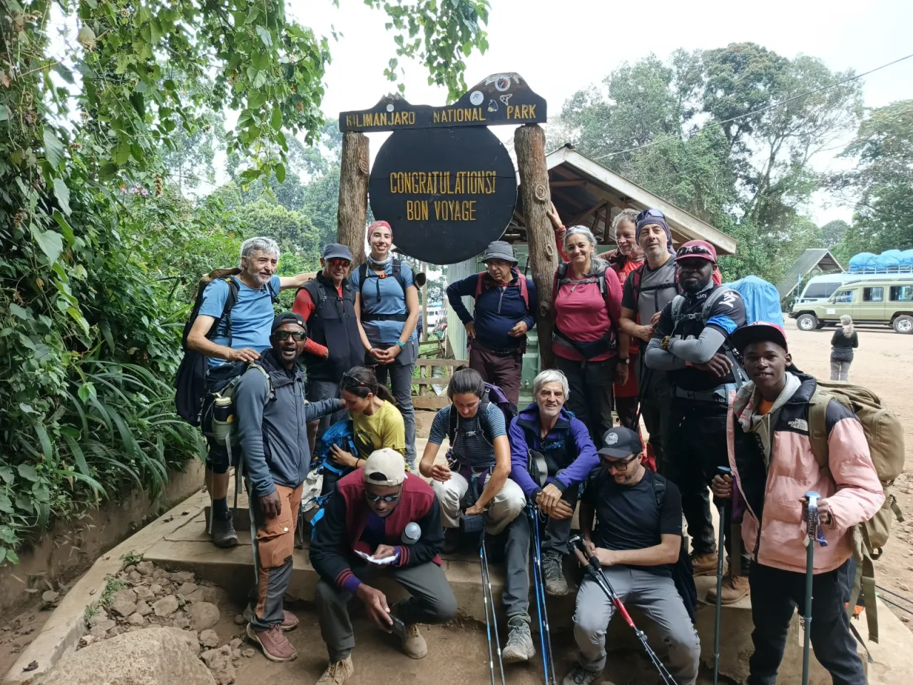
6-Day Umbwe Route
Kilimanjaro's steepest and most direct climb: up a forest ridge from Umbwe Gate to Barranco in two days, then the Barranco Wall, Karanga, Barafu and summit via Stella Point. For fit, experienced, ideally pre-acclimatised trekkers.
- Duration
- 6 days
- Route
- Umbwe Route
- Highest point
- 5,895 m
- Difficulty
- Very strenuous
- Climb style
- Private
The six-day Umbwe Route is the steepest and fastest way up Kilimanjaro. From Umbwe Gate (approx. 1,640 m) it climbs a narrow forest ridge to Umbwe Cave Camp (approx. 2,850 m), then continues above the trees to Barranco Camp (approx. 3,960 m) on day two. From there it follows the southern traverse shared with Machame and Lemosho: the Barranco Wall to Karanga Camp (approx. 3,995 m), Barafu Camp (approx. 4,670 m), summit night via Stella Point to Uhuru Peak (5,895 m) and the descent to Mweka Gate. Expect a hotel night in Moshi or Arusha before the climb for a briefing and kit check, and one afterwards.
Let us be plain about who this is for. The first two days gain over 2,300 m, several times the 300–500 m per day above 3,000 m that altitude-medicine guidance suggests, and the forest ridge is steep enough to need your hands. It suits strong hikers with previous high-altitude experience, or climbers who have recently acclimatised, for example on Mount Meru. For first-time high-altitude trekkers it is the wrong choice.
The Barranco Wall and Karanga days do give some climb-high, sleep-low before Barafu, but this six-day plan has no rest day. The seven-day Umbwe, which adds a night at Barranco with a walk towards Lava Tower, is the sensible minimum for most people considering this route. See the Umbwe Route page and our acclimatisation guide.
Highlights
- The most direct and quietest start of any Kilimanjaro route
- Steep ridge walk through montane forest with deep ravines either side
- Close views of the Breach Wall and southern icefields
- Barranco Wall scramble with no ropes needed
- Summit via Stella Point to Uhuru Peak (5,895 m)
- Descent through the forest on the Mweka trail
Day 1: Umbwe Gate to Umbwe Cave Camp
Umbwe Gate (approx. 1,640 m) is a short drive from Moshi up through farmland and villages on the southern slopes. After permits and the weighing of porter loads, you start on a forest track that soon narrows to a footpath and heads straight uphill. There is no warm-up on this route.
The trail follows a steep, narrow ridge through dense montane forest, with deep ravines dropping away on either side. In places the gradient is so steep that tree roots serve as steps and you pull yourself up with your hands. Moss hangs from the branches, and the forest is often wet and misty even in the dry season. Expect 5–7 hours (approx.) of steady, sweaty climbing. Poles help on the easier sections, but you will want your hands free on some of the root ladders.
Umbwe Cave Camp (approx. 2,850 m; sources quote up to 2,950 m) sits among the trees near a rock overhang on the ridge. You have gained about 1,200 m today, far more than on the first day of most routes, so drink well, eat properly and tell your guide about any headache. It is usually a quiet camp, with few other groups.
- From
- Umbwe Gate
- To
- Umbwe Cave Camp
- Altitude
- 2,850 m
- Walking
- 5–7 hours hours
Day 2: Umbwe Cave Camp to Barranco Camp
The ridge continues, steeper and narrower, and the forest thins into giant heather draped with lichen. Soon you are above the trees on an exposed spine with drops on both sides; it is not technical, but it is not a place to be careless in wind or rain. Ahead, Kibo's southern face comes into view, with the Breach Wall and the southern icefields directly above you. Expect 4–6 hours (approx.).
The trail then traverses and drops into the Barranco Valley, full of giant groundsels, to reach Barranco Camp (approx. 3,960 m). Here Umbwe joins the Machame and Lemosho routes, and the quiet ends: expect a busy camp.
Today is the honest problem with the six-day Umbwe. You gain about 1,100 m of sleeping altitude, on top of 1,200 m yesterday: over 2,300 m in two days. Wilderness Medical Society guidance suggests no more than 300–500 m of sleeping altitude per day above 3,000 m. Headache, nausea and poor sleep tonight are common, and your guide needs to hear about all of them. Anyone who feels unwell should not go higher until symptoms settle. The seven-day version adds a second night here with a walk towards Lava Tower, and is the better choice for most people.
- From
- Umbwe Cave Camp
- To
- Barranco Camp
- Altitude
- 3,960 m
- Walking
- 4–6 hours hours
Day 3: Barranco Camp to Karanga Camp via the Barranco Wall
The day starts with the Barranco Wall, a rock face of roughly 250 m (approx.) that climbs straight out of camp. It is a scramble, not a technical climb: you use your hands on rock steps and ledges, and there is one well-known narrow section where you hug the rock. No ropes are needed. After two days on the Umbwe ridge it will feel familiar. Go early, because Machame and Lemosho groups share the wall and it can queue.
From the top of the wall the views open south over the clouds and north to the Heim and Kersten glaciers. The trail then rolls across a series of ridges and valleys in alpine desert, with the final steep drop into and climb out of the Karanga Valley, the last reliable water source before the summit. Expect 4–5 hours (approx.).
Karanga Camp (approx. 3,995 m) sits at almost the same altitude as Barranco, so today is effectively a climb-high, sleep-low day: you go up over the wall and come back down to sleep at a similar height. After the gains of days one and two, that is exactly what your body needs. The afternoon is for rest, food and fluids.
- From
- Barranco Camp
- To
- Karanga Camp
- Altitude
- 3,995 m
- Walking
- 4–5 hours hours
Day 4: Karanga Camp to Barafu Camp
A short but steady climb over bare, rocky ridges in the alpine desert, usually 3–4 hours (approx.). There is almost no vegetation now, just gravel, boulders and wide views of Kibo's southern glaciers above and Mawenzi to the east. On the way you pass the junction with the Mweka descent trail, which you will use after the summit.
Barafu Camp (approx. 4,670 m) is strung along an exposed rocky ridge. Barafu means ice in Swahili, and the name fits: it is windy and cold, and tents are pitched between rocks on uneven ground. Your guide will point out the toilets and paths around camp in daylight, because moving around here in the dark is awkward.
You arrive around lunchtime and the rest of the day is about preparation. Eat a proper lunch, rest in your tent, and lay out your summit kit: base layers, insulated jacket, shell, warm gloves with liners, hat, head torch with fresh batteries, and water bottles you can keep inside your jacket. Dinner is early, around 17:00, followed by a summit briefing and a few hours of sleep, or at least rest, before the wake-up call.
- From
- Karanga Camp
- To
- Barafu Camp
- Altitude
- 4,670 m
- Walking
- 3–4 hours hours
Day 5: Summit night: Barafu Camp to Uhuru Peak, down to Mweka Camp
You are woken around 23:00 for tea and a light snack and leave near midnight by head torch. The path climbs about 1,100 m (approx.) of steep, rocky ground and loose scree to Stella Point on the crater rim, usually 5–7 hours (approx.) of slow, steady walking. It is often well below freezing, and wind chill can be severe. Keep moving, keep sipping from the bottle inside your jacket, and eat small snacks even if you do not want to.
Stella Point (approx. 5,756 m) is usually reached around dawn, and the sunrise over Mawenzi is the moment most people remember. From here it is roughly another hour (approx.) along the rim, past glaciers, to Uhuru Peak (5,895 m). You will have a few minutes for photos before heading down. Your guide will turn anyone back at any point if symptoms worsen; TANAPA's rules tell climbers not to push on when exhausted or with severe mountain sickness.
The descent to Barafu takes 2–3 hours (approx.), then you rest and eat before continuing down to Mweka Camp (approx. 3,100 m) in the heath zone, another 2–3 hours (approx.). The whole day is often 12–16 hours (approx.). Knees suffer more than lungs on the way down.
- From
- Barafu Camp
- To
- Mweka Camp
- Altitude
- 3,100 m
- Walking
- 12–16 hours hours
Day 6: Mweka Camp to Mweka Gate
The last morning is a descent of about 1,460 m (approx.) through heath and back into the montane forest, about 10 km (approx.) and usually 3–4 hours (approx.). TANAPA designates the Mweka route for descent only, so the only people you meet are other climbers on their way out. The path has many rough steps and can be very muddy and slippery after rain; walking poles and gaiters are worth keeping handy.
The forest on this side is thick and green, often busy with birds and sometimes with blue or colobus monkeys. With every hour the air feels richer, appetite returns and the aches of summit day start to fade into stories.
At Mweka Gate (approx. 1,640 m) you sign out of the park register, and successful climbers receive their summit certificate. This is usually where you thank your crew and say goodbye; our tipping guide explains how that normally works. From the gate it is a short drive back to your hotel in Moshi, or longer to Arusha, for a hot shower and a real bed.
- From
- Mweka Camp
- To
- Mweka Gate
- Altitude
- 1,640 m
- Walking
- 3–4 hours hours
- Distance
- 10.0 km
Frequently asked questions
Is the 6-day Umbwe Route suitable for beginners?
No. It gains over 2,300 m in the first two days and involves steep, sometimes hands-on ground. First-time high-altitude trekkers are better served by a longer route such as Machame, Lemosho or the Northern Circuit.
Why is the Umbwe Route so steep?
It follows a single ridge straight up the southern flank of the mountain rather than contouring around it. That makes it direct and quiet, but steep enough in the forest that tree roots serve as steps, and fast in altitude gain.
Should I do Umbwe in 6 or 7 days?
Seven if you can. The extra night at Barranco Camp (approx. 3,960 m) with a walk towards Lava Tower gives your body time to recover from the first two days. Six days is only sensible for climbers who arrive already acclimatised.
Where does the Umbwe Route finish?
At Mweka Gate (approx. 1,640 m) on the southern side. TANAPA reserves the Mweka trail for descent, and climbers on Umbwe, Machame and Lemosho all come down this way.