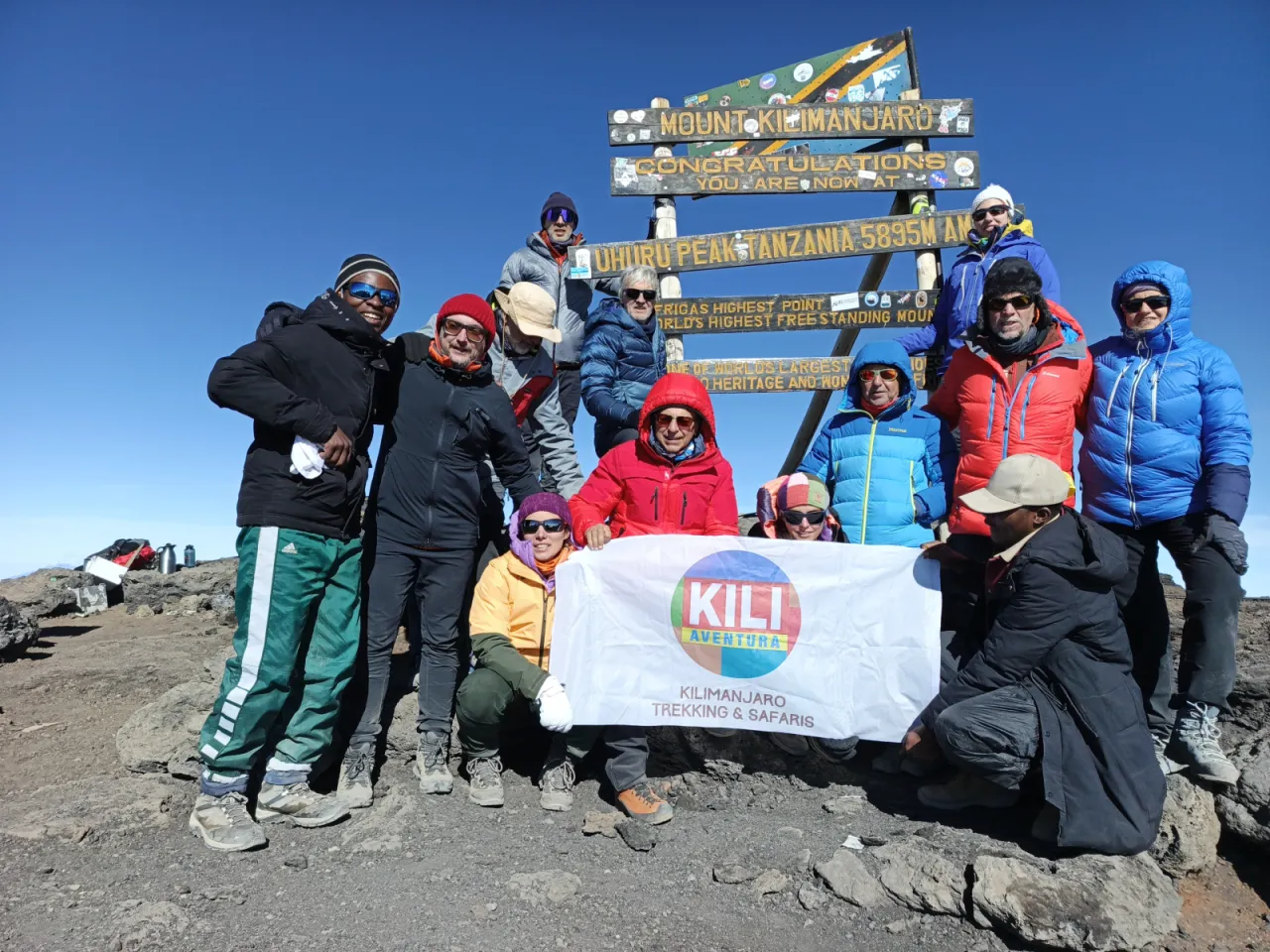
7-Day Machame Route
The classic seven-day Machame climb: rainforest, the Shira Plateau, a climb-high-sleep-low day via Lava Tower, the Barranco Wall and a short stage to Karanga before summit night from Barafu Camp. Descent via Mweka.
- Duration
- 7 days
- Route
- Machame Route
- Highest point
- 5,895 m
- Difficulty
- Challenging
- Climb style
- Private
This is the standard seven-day Machame itinerary and the one we suggest for most fit first-timers who want Machame's scenery. You start at Machame Gate (approx. 1,800 m) on the south-west side of Kilimanjaro, sleep six nights in tents, stand on Uhuru Peak (5,895 m) on the morning of day six and walk out through the forest to Mweka Gate on day seven. Plan on a hotel night in Moshi or Arusha before the climb for the gear check and briefing, and another afterwards for a long shower.
The acclimatisation logic is simple. Day two is a big jump in sleeping altitude, roughly 1,000 m. Day three repays that with a walk up to Lava Tower (approx. 4,630 m) and a night lower down at Barranco. The seventh day buys the short Barranco-to-Karanga stage, so you arrive at Barafu Camp with an extra night above 3,900 m and fresher legs than on the six-day version. In a 2019–2020 study of 1,237 Kilimanjaro hikers (Croughs et al., 2022), each extra day on the mountain independently predicted summit success.
The summit push leaves Barafu Camp (approx. 4,670 m) around midnight, reaches the crater rim at Stella Point around sunrise and continues to Uhuru Peak, then descends all the way to Mweka Camp (approx. 3,100 m). It is the hardest day of the climb by a wide margin.
Highlights
- Montane rainforest on day one, with black-and-white colobus monkeys often heard in the canopy
- Sunset over the Shira Plateau and Mount Meru from Shira 2 Camp
- Climb-high-sleep-low day via Lava Tower (approx. 4,630 m)
- Giant groundsels in the Barranco Valley and the Barranco Wall scramble
- Short Karanga stage that eases the altitude gain before Barafu
- Sunrise from Stella Point on the crater rim and Uhuru Peak (5,895 m)
- Views of the southern glaciers along the whole traverse
Day 1: Machame Gate to Machame Camp
You leave Moshi after breakfast for the drive of roughly an hour to Machame Gate (approx. 1,800 m), passing through Machame village and its banana and coffee plots. At the gate your guide registers the group with Kilimanjaro National Park while porters weigh their loads; the park limits each porter to 25 kg. Registration can take an hour or more on busy mornings, so bring a book and have lunch here or at the start of the trail.
The path climbs steadily through tall, wet montane forest: fig trees, tree ferns, hanging moss and, if you are lucky, black-and-white colobus monkeys crashing through the canopy. Outside the dry seasons the red clay turns slick, and gaiters earn their place. Nothing here is steep, but it is relentless, and the single most useful thing you can do is walk slower than feels necessary. Guides will say "pole pole" (slowly, slowly) until you hear it in your sleep.
The forest thins into giant heather just before Machame Camp (approx. 2,835 m). Your tents will usually be up when you arrive. Wash with the bowl of warm water, drink a lot, and expect the first cold night: temperatures near freezing are normal here.
- From
- Machame Gate
- To
- Machame Camp
- Altitude
- 2,835 m
- Walking
- 5–7 hours hours
- Distance
- 11.0 km
Day 2: Machame Camp to Shira 2 Camp
Day two is short in distance and steep in feel. From Machame Camp the trail climbs a rocky ridge through heath and giant heather, with a few easy hands-on steps where the path crosses bare rock. On a clear morning Kibo appears above you for the first time, and the forest you walked through yesterday becomes a green sea below.
This is the day that matters most for acclimatisation, and not in a good way. You gain roughly 1,000 m of sleeping altitude, which is more than altitude-medicine guidelines recommend once above 3,000 m. That is why guides set a very slow pace, stop often for water, and ask you how you feel more than once. A mild headache by the afternoon is common; tell your guide rather than toughing it out.
The trail eases as it crosses a stream gully and levels onto the edge of the Shira Plateau. Shira 2 Camp (approx. 3,850 m) sits on open moorland with views west to the plateau and, at sunset, across the clouds to Mount Meru. Once the sun goes, it gets properly cold. Put on your warm layers before you feel you need them.
- From
- Machame Camp
- To
- Shira 2 Camp
- Altitude
- 3,850 m
- Walking
- 4–6 hours hours
- Distance
- 5.0 km
Day 3: Shira 2 Camp to Barranco Camp via Lava Tower
This is the acclimatisation day, and it is designed to feel harder than it looks on paper. You head east out of Shira 2 across a gradually rising landscape of scree and lava rock, leaving the last heather behind for alpine desert. Kibo's western glaciers get closer all morning.
Lunch is at or near Lava Tower (approx. 4,630 m), a tall volcanic plug standing alone on a stony shoulder. This is the highest you have been, and plenty of climbers get a headache, feel sluggish or lose their appetite here. That is the point of the day: your body gets a strong signal to adapt, and then you go down to sleep. Eat what you can, even if it is only soup and bread.
The afternoon descent into the Barranco Valley is steep in places and goes on longer than people expect, roughly two to three hours (approx.). Giant groundsels and lobelias appear along the stream beds, and the camp sits under the cliffs of the Western Breach with the Barranco Wall across the valley. Barranco Camp (approx. 3,960 m) is only about 110 m higher than last night's camp, so most people sleep better tonight than they did at Shira.
- From
- Shira 2 Camp
- To
- Barranco Camp
- Altitude
- 3,960 m
- Walking
- 6–8 hours hours
- Distance
- 10.0 km
Day 4: Barranco Camp to Karanga Camp via the Barranco Wall
The morning starts with the Barranco Wall, the rock face that looked alarming from camp last night. In practice it is a steep, well-worn scramble of roughly 250 m in height (approx.), taking an hour or two. You use your hands for balance on a handful of steps, and there is one famous spot, the "kissing rock", where you hug the rock face to shuffle past. No ropes or climbing skills are needed. If heights make you nervous, tell your guide; they will keep you close and place your hands and feet.
Groups from Machame, Lemosho and Umbwe all leave Barranco at around the same time, so there can be a queue at the bottom. Leaving slightly early or slightly late often helps.
From the top of the Wall the trail rolls across alpine desert, with the Heim and Kersten glaciers above and the plains far below. The last section drops into the Karanga Valley, the last reliable water source before the summit, and climbs back out to Karanga Camp (approx. 3,995 m). You arrive around lunchtime with a free afternoon. Rest, eat, and keep drinking: this short day is what separates the seven-day from the six-day climb.
- From
- Barranco Camp
- To
- Karanga Camp
- Altitude
- 3,995 m
- Walking
- 4–5 hours hours
- Distance
- 5.0 km
Day 5: Karanga Camp to Barafu Camp
A short, steady climb of roughly 675 m through bare alpine desert brings you to base camp. The trail joins the Mweka descent path near the top, so you are looking at the way you will come down tomorrow. There is little shade, the air is dry, and the wind picks up as you go higher. Keep drinking even if you are not thirsty.
Barafu Camp (approx. 4,670 m) is strung out along a rocky, exposed ridge. "Barafu" means ice in Swahili, and the name is fair. Tents are pitched on uneven ground between boulders, so watch your step if you leave the tent at night, and keep your head torch handy.
The afternoon is about preparation, not sightseeing. You will have an early dinner, a summit briefing from your guide, and a health check with the pulse oximeter. Lay out your summit clothes in order, put spare batteries and your water bottles somewhere they will not freeze (inside your sleeping bag works), and try to sleep by about 19:00. Most people doze rather than sleep. That is normal and it still helps.
- From
- Karanga Camp
- To
- Barafu Camp
- Altitude
- 4,670 m
- Walking
- 3–5 hours hours
- Distance
- 4.0 km
Day 6: Summit day: Barafu Camp to Uhuru Peak, down to Mweka Camp
You are woken around 23:00 for tea and biscuits and leave at about midnight. The climb from Barafu to Stella Point on the crater rim gains roughly 1,080 m on switchbacks through scree and rock, lit only by head torches. Expect around six to seven hours (approx.) at a very slow, rhythmic pace, with short stops so you do not cool down. Temperatures near the rim are usually well below freezing, and wind makes it feel colder. Water in exposed bottles freezes; keep a bottle inside your jacket.
Most groups reach Stella Point (approx. 5,756 m) around sunrise. From there it is a gentler 45 to 60 minutes along the rim to Uhuru Peak (5,895 m), past the southern icefields. You stay for photos, not long: your guide will want you heading down while you still have energy.
The descent to Barafu takes around two to three hours on loose scree. After a rest and a meal you continue down the Mweka trail for another three to four hours (approx.) to Mweka Camp (approx. 3,100 m), back into heather and the edge of the forest. You will be exhausted, and the thicker air makes the evening feel like a celebration.
- From
- Barafu Camp
- To
- Mweka Camp
- Altitude
- 3,100 m
- Walking
- 12–16 hours hours
- Distance
- 17.0 km
Day 7: Mweka Camp to Mweka Gate
The last morning often starts with the crew singing, and it is worth getting out of the tent for. After breakfast you walk down through montane forest on a well-made but steep path with plenty of steps. Knees and thighs feel yesterday's descent, so walking poles help, and in the wet months the lower sections can be muddy and slippery. Take it steady: most ankle sprains on Kilimanjaro happen on the way down, not up.
The forest is noticeably warmer and louder than anything you have seen for five days, with birdsong and, sometimes, blue monkeys or colobus in the trees. You drop about 1,460 m in three to four hours (approx.).
At Mweka Gate (approx. 1,640 m) your guide signs you out of the park, and climbers who reached Stella Point or Uhuru Peak receive their summit certificates. This is also usually where the crew say goodbye and tips are handed over. A vehicle takes you back to Moshi or Arusha for a shower, a proper bed and, for most people, a very long sleep.
- From
- Mweka Camp
- To
- Mweka Gate
- Altitude
- 1,640 m
- Walking
- 3–4 hours hours
- Distance
- 10.0 km
Frequently asked questions
Is the 7-day Machame Route better than the 6-day?
For most people, yes. The seventh day adds a night at Karanga Camp, so the gain from Barranco to Barafu is split over two days instead of one. You reach base camp better rested and with an extra night of acclimatisation, and a large Kilimanjaro study found that each extra day on the mountain predicted summit success.
How many hours a day do you walk on the 7-day Machame?
Most days are three to seven hours of walking. Day three via Lava Tower is around six to eight hours, and summit day is the long one: roughly 12 to 16 hours from the midnight start at Barafu to arrival at Mweka Camp.
What time do you start summit night on the Machame Route?
Climbers are usually woken around 23:00 at Barafu Camp and start walking at about midnight. That timing puts most groups at Stella Point around sunrise and leaves enough daylight to descend to Mweka Camp the same day.
How cold is it on the 7-day Machame Route?
Nights at Machame Camp are cool and often near freezing, and from Shira 2 onwards night temperatures are regularly below zero. The coldest hours are on summit night near the crater rim, where it is usually well below freezing before sunrise and wind chill adds to it. A warm sleeping bag and a proper down jacket are essential.