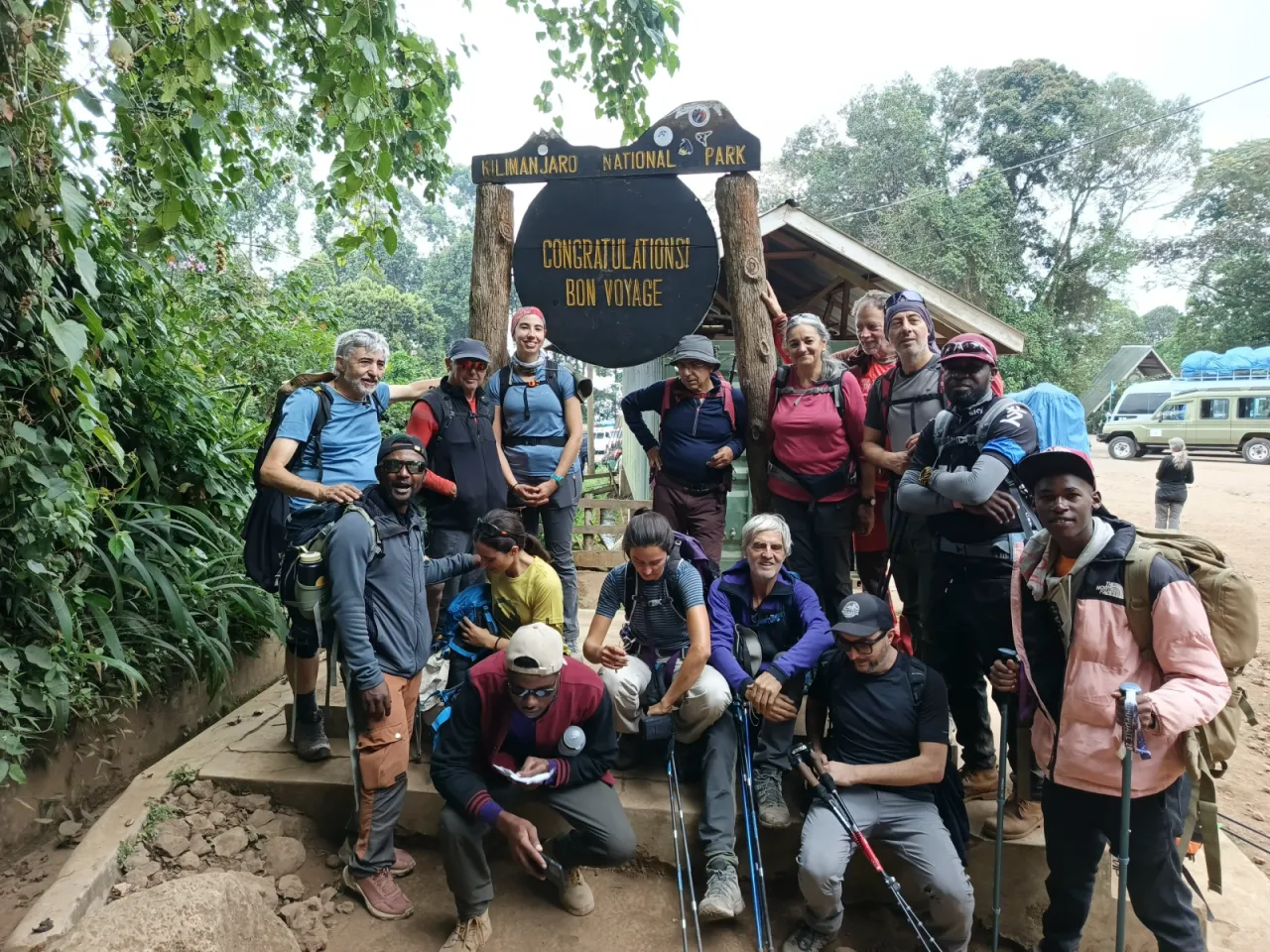
9-Day Northern Circuit
The longest standard climb on Kilimanjaro: the Lemosho forest start and Shira Plateau, Lava Tower, then four days round the remote northern slopes via Moir Hut, Buffalo Camp and Third Cave to School Hut, with a summit push via Gilman's Point.
- Duration
- 9 days
- Route
- Northern Circuit
- Highest point
- 5,895 m
- Difficulty
- Challenging
- Climb style
- Private
The nine-day Northern Circuit is the itinerary for climbers who want the most time to acclimatise and the quietest trail on the mountain. It starts like the Lemosho Route: registration at Londorossi Gate, a drive to the Lemosho trailhead (approx. 2,390 m), forest, then the Shira Plateau. After Lava Tower, instead of dropping into the busy Barranco Valley, you turn north to Moir Hut and spend three days circling Kibo's northern slopes via Buffalo Camp and Third Cave to School Hut (approx. 4,750 m). Summit night reaches the crater rim at Gilman's Point, continues to Uhuru Peak (5,895 m) and descends the southern side to Mweka Camp. Allow a hotel night in Moshi or Arusha before and after.
The acclimatisation logic is time. After a gradual start (approx. 2,780 m, 3,505 m, 3,850 m) and a climb-high day via Lava Tower, you sleep three nights between about 3,870 m and 4,200 m on the northern traverse before moving up to School Hut. That is more nights above 3,500 m than any other standard route. It is not perfect: the days to Shira 1 and to School Hut both gain more than 500 m of sleeping altitude, and School Hut is a cold, high place to spend the night before the summit.
The trade-offs are length and cold: nine days of camping, several nights below freezing, and a summit day that ends a long way down on the other side of the mountain.
Highlights
- Quiet western rainforest start and the full Shira Plateau crossing
- Lava Tower (approx. 4,630 m) acclimatisation day
- Three nights on the remote northern slopes, far from the crowds
- Views north across the plains towards Kenya
- Mawenzi's jagged peak close up from Third Cave and School Hut
- Summit via Gilman's Point, then along the crater rim to Uhuru Peak (5,895 m)
- The most nights at altitude of any standard Kilimanjaro itinerary
Day 1: Londorossi Gate and Lemosho trailhead to Mti Mkubwa Camp
The first day starts with a long drive from Moshi or Arusha round to Kilimanjaro's western side, several hours in total (approx. three to four, depending on your start point and road conditions). At Londorossi Gate your guide registers the group with Kilimanjaro National Park, and the crew's loads are weighed against the park's 25 kg limit per porter. The vehicles then continue along a forest track to the Lemosho trailhead (approx. 2,390 m), where you usually eat lunch before setting off.
The walk is short and gently uphill through old montane forest: huge trees, tangles of creepers and moss, and a quiet that the busier southern gates do not have. Black-and-white colobus monkeys are the most likely mammals to see. Buffalo and elephant also use these forests, but sightings from the trail are rare.
Mti Mkubwa Camp (approx. 2,780 m), Swahili for "big tree", sits in a forest clearing. It is damp and cool in the evening but rarely freezing. Nine days is a long time on a mountain, so use this easy start to learn the camp routine, drink more than you think you need and get a good night's sleep.
- From
- Lemosho trailhead (after registration at Londorossi Gate)
- To
- Mti Mkubwa (Big Tree) Camp
- Altitude
- 2,780 m
- Walking
- 3–4 hours hours
- Distance
- 6.0 km
Day 2: Mti Mkubwa Camp to Shira 1 Camp
The forest thins quickly this morning, giving way to giant heather and heath that grows well above head height, hung with pale lichen. The trail climbs a long ridge, steep in places, with views opening up behind you over the forest and, on a clear day, to Mount Meru in the west.
By around midday you reach the western rim of the Shira Plateau, the broad caldera left when Shira, the oldest of Kilimanjaro's three volcanic peaks, collapsed. Kibo comes into view across the plateau, snow on its summit and still a long way off. The afternoon is an easy walk across moorland of tussock grass and everlasting flowers to camp.
You gain about 725 m of sleeping altitude today, one of the two days on this itinerary above the 500 m a day that altitude guidelines suggest. Guides keep the pace slow and begin daily health checks. Shira 1 Camp (approx. 3,505 m) is open and exposed. After the shelter of the forest the evening chill comes as a shock: nights here are often below freezing, and frost on the tents at dawn is normal. The sunset over the plateau is usually worth standing out in the cold for.
- From
- Mti Mkubwa (Big Tree) Camp
- To
- Shira 1 Camp
- Altitude
- 3,505 m
- Walking
- 5–6 hours hours
- Distance
- 8.0 km
Day 3: Shira 1 Camp to Shira 2 Camp across the Shira Plateau
A relaxed day across the heart of the Shira Plateau. The track is wide and gently rising, and Kibo grows steadily ahead of you. It is a good day to walk side by side with your guide and ask all the questions you have been saving: about the mountain, the crew, the summit plan.
Many guides add a detour to Shira Cathedral, a rocky ridge on the southern side of the plateau, which gives a little extra height and views down over the cloud (approx. one to two hours extra). Others go more directly. Either way, you arrive at camp with time to rest.
Sleeping altitude rises by only about 345 m today, comfortably within altitude guidelines, so most people feel better tonight than at Shira 1. Shira 2 Camp (approx. 3,850 m) is where the Machame and Lemosho routes converge, so it is the busiest camp you will see until the descent. Enjoy the company; from tomorrow night the Northern Circuit leaves most of these groups behind. Clear evenings bring cold air and wide views, with Mount Meru floating above the clouds to the west.
- From
- Shira 1 Camp
- To
- Shira 2 Camp
- Altitude
- 3,850 m
- Walking
- 4–6 hours hours
Day 4: Shira 2 Camp to Moir Hut Camp via Lava Tower
This is the day the Northern Circuit parts company with the crowds. From Shira 2 you climb east into alpine desert along the same trail as the Machame and Lemosho climbers, over scree and lava rock towards Kibo's western flank. The air is thin, the sun is strong and there is little shelter from the wind.
Around lunchtime you reach Lava Tower (approx. 4,630 m), a lone volcanic plug below the Western Breach. It is the highest point so far and a strong acclimatisation stimulus; a headache or loss of appetite here is common. Eat and drink what you can.
While everyone else drops south into the Barranco Valley, you turn north on a quieter path that contours below Kibo's western slopes and descends to Moir Hut Camp (approx. 4,200 m), in a sheltered, rocky valley beneath the Lent Hills. You sleep in tents. Tonight's camp is about 350 m higher than Shira 2 and noticeably colder than Barranco would be, but it is usually very quiet. Expect a hard frost and a sky full of stars.
- From
- Shira 2 Camp
- To
- Moir Hut Camp
- Altitude
- 4,200 m
- Walking
- 6–8 hours (approx.) hours
Day 5: Moir Hut Camp to Buffalo Camp
The northern traverse starts here. From Moir Hut the path climbs out of the valley onto Kibo's northern shoulder, then contours east across a series of ridges and dry gullies. Some groups first make an optional side trip up the Lent Hills above camp for extra height and views of the Northern Icefield; your guide will decide depending on how everyone is feeling.
The landscape is stark and wide: rock, gravel and scattered everlasting flowers, with the northern slopes falling away towards the plains of the Kenya border and, on very clear days, the Amboseli area far below. There is far less traffic here than on the southern circuit, and you may walk for hours without meeting another group.
The trail undulates rather than climbs, and you finish lower than you started. That is deliberate: a day spent between about 4,000 m and 4,300 m (approx.) followed by a night at Buffalo Camp (approx. 4,020 m) keeps your body working at altitude without pushing sleeping height higher. Buffalo Camp sits on an open slope with long views north. Like all the northern camps it is cold at night, and the wind can be strong.
- From
- Moir Hut Camp
- To
- Buffalo Camp
- Altitude
- 4,020 m
- Walking
- 5–7 hours (approx.) hours
Day 6: Buffalo Camp to Third Cave Camp
Another day of rolling walking round the north side of Kibo. The trail heads east and slightly downhill, crossing ridges and valleys where patches of heath and hardy grasses return among the rock. Kibo's northern glaciers are above you for much of the morning, and Mawenzi, Kilimanjaro's jagged second peak, starts to dominate the view ahead.
Towards the end of the day you meet the Rongai route, which comes up from the north-east; Third Cave is also a camp on that route, named after one of the rock shelters on this side of the mountain.
Third Cave Camp (approx. 3,870 m) is the lowest camp since Shira 2, and that is the point of the day. After three nights at or above about 4,000 m, dropping slightly lets your body recover and sleep better before the final move up to School Hut. Use the afternoon to rest, sort your summit kit and drink plenty; tomorrow afternoon you will want to be resting, not packing. It is usually cold and clear at night, with views over the plains to the north-east.
- From
- Buffalo Camp
- To
- Third Cave Camp
- Altitude
- 3,870 m
- Walking
- 5–6 hours (approx.) hours
Day 7: Third Cave Camp to School Hut Camp
A steady climb of roughly 880 m brings you to your summit base camp. The trail heads south-west up towards the Saddle, the high, barren plain between Kibo and Mawenzi, on sandy paths and loose rock. There is almost no vegetation now, and the air feels thin again. Go slowly and drink often: this is the second day on this itinerary that gains well over 500 m of sleeping altitude.
The views are some of the best of the climb. Mawenzi's spires rise to the east, the Saddle stretches out beside you, and Kibo's summit cone looms directly above. You arrive at School Hut Camp (approx. 4,750 m) around lunchtime.
School Hut is high, exposed and cold, and it is common to feel the altitude here: a headache, poor appetite or restless sleep. The afternoon is for rest. Your guide will check your oxygen saturation, give a summit briefing and go over timings and kit. Eat an early dinner, lay out your summit clothes in order, keep water bottles and batteries inside your sleeping bag, and be lying down by about 18:30. It is a short night.
- From
- Third Cave Camp
- To
- School Hut Camp
- Altitude
- 4,750 m
- Walking
- 4–5 hours (approx.) hours
Day 8: Summit day: School Hut to Uhuru Peak via Gilman's Point, down to Mweka Camp
You are woken around 23:00 and start walking at about midnight. The route climbs steep switchbacks of scree and rock up Kibo's eastern side, usually joining the trail used by Marangu and Rongai climbers near Hans Meyer Cave (approx. 5,150 m). The going is slow and rhythmic in the dark and the cold, which is usually well below freezing with wind chill on top. The final section to the rim is the steepest and loosest.
You reach Gilman's Point (approx. 5,685 m) on the crater rim, roughly 930 m above School Hut, around dawn. From there the path follows the rim south and west past Stella Point (approx. 5,756 m) to Uhuru Peak (5,895 m), about one and a half to two hours further (approx.), with the crater and its glaciers beside you.
After photos you descend via Stella Point down the scree to Barafu Camp (approx. 4,670 m) on the south side, where you rest and eat. You then continue down the Mweka trail to Mweka Camp (approx. 3,100 m). It is the longest day of the climb, often 13 to 16 hours in total, and you finish on the opposite side of the mountain from where you slept last night.
- From
- School Hut Camp
- To
- Mweka Camp
- Altitude
- 3,100 m
- Walking
- 13–16 hours (approx.) hours
Day 9: Mweka Camp to Mweka Gate
After eight nights on the mountain, the last morning is short and all downhill. You descend roughly 1,460 m from Mweka Camp through the upper heath and into thick montane forest on a steep path with many earth and log steps. Tired knees feel every one of them, so walking poles help, and in the rainy months the path is muddy and slick. Go steadily; this is where people who relax too much twist ankles.
The forest feels almost tropical after days of rock and frost: warm air, birdsong, wet earth and, often, blue monkeys or black-and-white colobus in the canopy near the lower trail. Many crews sing for their climbers before leaving camp, and after nine days together it is a fitting goodbye.
At Mweka Gate (approx. 1,640 m) your guide signs the group out of Kilimanjaro National Park. Climbers who reached Gilman's Point, Stella Point or Uhuru Peak receive the matching summit certificate. This is usually where tips are handed over to the crew. A vehicle then takes you back to Moshi or Arusha, typically arriving by early afternoon.
- From
- Mweka Camp
- To
- Mweka Gate
- Altitude
- 1,640 m
- Walking
- 3–4 hours hours
- Distance
- 10.0 km
Frequently asked questions
Why does the Northern Circuit take nine days?
It is the longest way round the mountain. After the Lemosho start and the Shira Plateau, it circles Kibo's northern slopes instead of taking the shorter southern traverse, and it spends three nights between about 3,870 m and 4,200 m before moving to School Hut. The extra days are what give it the best acclimatisation profile of the standard routes.
Where do you start summit night on the Northern Circuit?
Summit night starts from School Hut Camp (approx. 4,750 m) on Kibo's eastern side. You climb to the crater rim at Gilman's Point, then walk along the rim past Stella Point to Uhuru Peak (5,895 m), and descend the southern side via Barafu to Mweka Camp.
Does the 9-day Northern Circuit go over the Barranco Wall?
No. The route leaves the southern circuit at Lava Tower and heads north to Moir Hut, so it never enters the Barranco Valley or climbs the Barranco Wall. The only scrambling is on rocky sections near the crater rim.
How cold are the northern camps on Kilimanjaro?
Moir Hut, Buffalo Camp, Third Cave and School Hut are all between about 3,870 m and 4,750 m, and nights are regularly below freezing. School Hut is the coldest because of its height and exposure. A sleeping bag suited to well below zero and a warm down jacket are essential on this itinerary.